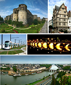
Angers
Angers, jû sûka dewleta Fransaya.[1] Erdê sûke 42,7 km2 ca gêno. Na sûke 20 m derya ra berza.
 | |
| Melumat | |
| Dewlete | Fransa |
| Mıntıqa | Communauté urbaine Angers Loire Métropole |
| Merkezê idarey | Maine-et-Loire, Anjou, arrondissement of Angers, canton of Angers-Sud, canton of Angers-Est, canton of Angers-Nord, canton of Angers-Ouest, canton of Angers-Trélazé, canton of Angers-Nord-Est, canton of Angers-Centre, canton of Angers-Nord-Ouest, canton of Angers-3, canton of Angers-2, canton of Angers-1, canton of Angers-4, canton of Angers-5, canton of Angers-6 û canton of Angers-7 |
| Ware | Maine-et-Loire, Communauté urbaine Angers Loire Métropole û arrondissement of Angers |
| Erd | 42,71 km2 |
| Nıfus | 157 175 |
| Berziye | 20 m |
| Serdar | Q118314528 |
| Letey saete | UTC+01.00 |
| Kodê postey | 49000 |
| Geokod | 3037656 |
| Website | www.angers.fr |
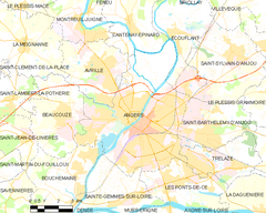
| Xerita | |
 | |
| Wikidata sera bıvurne | |
Sûkê wayiye
bıvurnePiza, Osnabrück, Bamako, Wigan, Yantai, Södertälje Municipality, Austin, Haarlem, Torun û Sevilla
Nıfus
bıvurneGrafikê diagrami sero gorey seran ra nıfusê Angersi;
1793 ra heta 2021 nıfus
| Amarê nıfus | 33,900 | 35,901 | 51,797 | 73,044 | 83,786 | 94,408 | 136,038 | 147,571 | 155,543 | 157,175 |
| 1793 | 1836 | 1861 | 1886 | 1911 | 1946 | 1982 | 2010 | 2016 | 2021 |
Çıme: Wikidata
Bıvênên
bıvurneÇıme
bıvurne| Arşivê Embarê Wikimedya de heqa Angers de vêşêri multimedya esta. |

