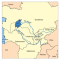
Dosya:Aral map.png
Aral_map.png (279 × 281 pikselan, ebatê dosya: 19 KB, MIME tipê cı: image/png)
Verêniya dosya
Seba diyayışê viyarteyê dosya ra tarixê ke qısımê tarix/zemani derê inan bıtıkne.
| Tarix/Zeman | Resımo qıckek | Ebadi | Karber | Mışewre | |
|---|---|---|---|---|---|
| nıkayên | 17:41, 9 Nisane 2008 |  | 279 - 281 (19 KB) | Claus Obana | |
| 14:02, 22 Çele 2007 |  | 300 - 300 (18 KB) | Kmusser | added label for Naryn River | |
| 18:52, 16 Tışrino Peyên 2005 |  | 300 - 300 (16 KB) | Kmusser | ||
| 18:33, 16 Tışrino Peyên 2005 |  | 300 - 300 (65 KB) | Kmusser | This is a map of area around the Aral Sea including the Amu Darya and Syr Darya rivers. I, Karl Musser, created it based on USGS data. The Aral Sea b |
Gurenayışê dosya
Gurenayışê dosyaya gılovere
Ena dosya wikiyanê binan de gureniyena.
- af.wikipedia.org sero guriyayış
- ar.wikipedia.org sero guriyayış
- arz.wikipedia.org sero guriyayış
- ast.wikipedia.org sero guriyayış
- az.wikipedia.org sero guriyayış
- ba.wikipedia.org sero guriyayış
- be-tarask.wikipedia.org sero guriyayış
- be.wikipedia.org sero guriyayış
- bg.wikipedia.org sero guriyayış
- br.wikipedia.org sero guriyayış
- ca.wikipedia.org sero guriyayış
- ceb.wikipedia.org sero guriyayış
- cs.wikipedia.org sero guriyayış
- cv.wikipedia.org sero guriyayış
- cy.wikipedia.org sero guriyayış
- da.wikipedia.org sero guriyayış
- de.wikipedia.org sero guriyayış
- el.wikipedia.org sero guriyayış
- en.wikipedia.org sero guriyayış
- en.wiktionary.org sero guriyayış
- eo.wikipedia.org sero guriyayış
- es.wikipedia.org sero guriyayış
- eu.wikipedia.org sero guriyayış
- fa.wikipedia.org sero guriyayış
- fi.wikipedia.org sero guriyayış
- fr.wikipedia.org sero guriyayış
Yê na dosya gurenayışê gıloveri tayêna bıvêne.


