Dosya:California county map (San Francisco County enlarged).svg

Ebadê verqaytê PNG na dosyay SVG: 508 × 600 piksel. Agoznayışê bini: 203 × 240 piksel | 407 × 480 piksel | 651 × 768 piksel | 867 × 1,024 piksel | 1,735 × 2,048 piksel | 621 × 733 piksel.
Ebato oricinale (Dosyay SVGi, nominal 621 × 733 pikseli, ebadê dosya: 506 KB)
| Na dosya depoyê Wikimedia Commons de esta u terefê proceyanê binan ra gureniyena. Cêr dê şınasiya dosyay pela mocniyeno. |
Xulasa
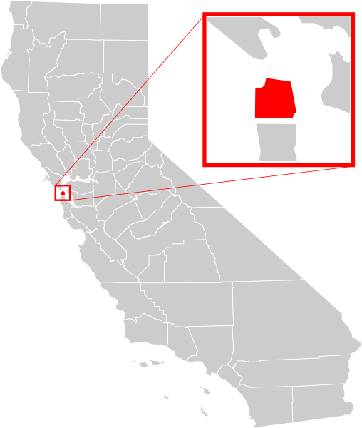
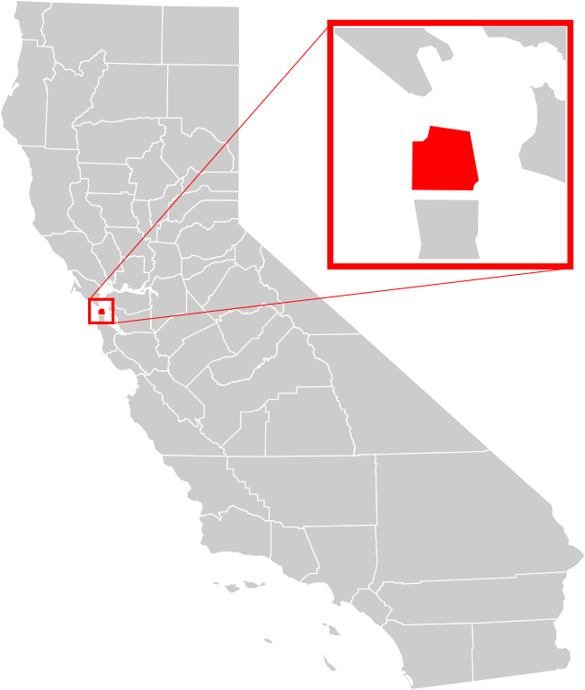
| Şınasnayış | A county locator map of California, with San Francisco County highlighted and enlarged in red. |
| Tarix | |
| Çıme | Own work based on: California county map (San Francisco County highlighted).svg and California Map showing San Francisco County.png |
| Nuştekar | Optigan13 based on works of Thadius856 and Kurykh |
| Versiyonane binan |
|
| SVG genesis | and with Inkscape. This Adobe SVG locator map is very large because Optigan13 kept the superfluous Adobe PGF or other CDATA garbage . |
.svg)

.svg)
Lisans
| Ez, Wêrê ena teliferê, nê kari Malê şarideye ezo heserena. Dınya heme ca dı ravêreno. Tay dewletan dı no kanuniyey heta mıkum nêbone; o haldı: Ez, ena karer qande herhangi yew amaci, be şert, hendı ke legali icab nikeni, şari hemi re ezo mısade dana. |
Verêniya dosya
Seba diyayışê viyarteyê dosya ra tarixê ke qısımê tarix/zemani derê inan bıtıkne.
| Tarix/Zeman | Resımo qıckek | Ebadi | Karber | Mışewre | |
|---|---|---|---|---|---|
| nıkayên | 07:10, 19 Hezirane 2008 | | 621 - 733 (506 KB) | Optigan13 | {{Information |Description=A county locator map of California, with San Francisco County highlighted and enlarged in red. |Source=Image:California county map (San Francisco County highlighted).svg and [[:Image:California Map showing San Francisco Cou |
.svg)
Gurenayışê dosya
The following pages link to this file:
Gurenayışê dosyaya gılovere
Ena dosya wikiyanê binan de gureniyena.
- af.wikipedia.org sero guriyayış
- ang.wikipedia.org sero guriyayış
- ar.wikipedia.org sero guriyayış
- arz.wikipedia.org sero guriyayış
- ast.wikipedia.org sero guriyayış
- bg.wikipedia.org sero guriyayış
- bn.wikipedia.org sero guriyayış
- ca.wikipedia.org sero guriyayış
- ceb.wikipedia.org sero guriyayış
- chy.wikipedia.org sero guriyayış
- el.wikipedia.org sero guriyayış
- en.wikipedia.org sero guriyayış
- San Francisco
- Presidio of San Francisco
- North Beach, San Francisco
- Yerba Buena Island
- Treasure Island, San Francisco
- Richmond District, San Francisco
- Sunset District, San Francisco
- Noe Valley, San Francisco
- Haight-Ashbury
- Golden Gate Park
- Bayview–Hunters Point, San Francisco
- Chinatown, San Francisco
- South of Market, San Francisco
- Civic Center, San Francisco
- Mission District, San Francisco
- Japantown, San Francisco
- San Francisco City Hall
- Ocean Beach, San Francisco
- Bernal Heights, San Francisco
- Anza Vista, San Francisco
- Duboce Triangle, San Francisco
- San Francisco Cable Car Museum
- Russian Hill, San Francisco
- Moscone Recreation Center
- Union Square, San Francisco
- West Portal, San Francisco
- List of neighborhoods in San Francisco
- Embarcadero (San Francisco)
- Alamo Square, San Francisco
- Fisherman's Wharf, San Francisco
- Hayes Valley, San Francisco
- Western Addition, San Francisco
- Glen Park, San Francisco
- Financial District, San Francisco
- St. Francis Wood, San Francisco
- Cole Valley, San Francisco
- Excelsior District, San Francisco
Yê na dosya gurenayışê gıloveri tayêna bıvêne.
.svg)
.svg)