Dosya:Gales Bay.jpg
Vervênayışê ebadê: 800 × 536 piksel. Agoznayışê bini: 320 × 214 piksel | 640 × 429 piksel | 1,024 × 686 piksel | 1,280 × 857 piksel.
Ebato oricinale (1,280 × 857 pikselan, ebatê dosya: 146 KB, MIME tipê cı: image/jpeg)
| Na dosya depoyê Wikimedia Commons de esta u terefê proceyanê binan ra gureniyena. Cêr dê şınasiya dosyay pela mocniyeno. |
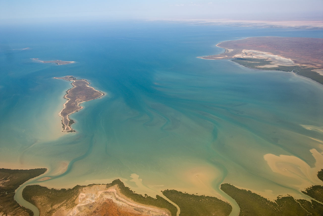
| Şınasnayış | This is an aerial photograph of Gales Bay, a bay at the south end of Exmouth Gulf, Western Australia. The nearest foreground is Doole Island; behind it is Roberts Island; the further island is possibly Whitmore Island. The land on the right is the Sandalwood Peninsula. In the top right hand corner some of Giralia Bay can just be seen; across the top can be seen the continuing coastline of Western Australia. |
| Tarix | |
| Çıme | https://www.flickr.com/photos/61952179@N00/366312114/ |
| Nuştekar | Jon Hanson |
| Destur (Reyna sixulnayise ena dosya) |
Ena dosya binê Creative Commons Attribution-Share Alike 2.0 Generic lisans biya.
|
| Camera location | | View this and other nearby images on: OpenStreetMap |
|---|
| This image, originally posted to Flickr, was reviewed on 18 May 2008 by the administrator or reviewer Kanonkas, who confirmed that it was available on Flickr under the stated license on that date. |
Verêniya dosya
Seba diyayışê viyarteyê dosya ra tarixê ke qısımê tarix/zemani derê inan bıtıkne.
| Tarix/Zeman | Resımo qıckek | Ebadi | Karber | Mışewre | |
|---|---|---|---|---|---|
| nıkayên | 12:20, 18 Gulane 2008 | | 1,280 - 857 (146 KB) | Hesperian | {{Information |Description=This is an aerial photograph of Gales Bay, a bay at the south end of Exmouth Gulf, Western Australia. The island in the foreground is Doole Island; behind it is Roberts Island; the further island is ''possibl |
Gurenayışê dosya
There are no pages that link to this file.
Gurenayışê dosyaya gılovere
Ena dosya wikiyanê binan de gureniyena.
- ar.wikipedia.org sero guriyayış
- arz.wikipedia.org sero guriyayış
- ceb.wikipedia.org sero guriyayış
- de.wikipedia.org sero guriyayış
- en.wikipedia.org sero guriyayış
- fi.wiktionary.org sero guriyayış
- lt.wikipedia.org sero guriyayış
- nl.wikipedia.org sero guriyayış
- pnb.wikipedia.org sero guriyayış
- ur.wikipedia.org sero guriyayış
- www.wikidata.org sero guriyayış