Dosya:IsraelCVFRtopography.jpg
Vervênayışê ebadê: 446 × 599 piksel. Agoznayışê bini: 179 × 240 piksel | 357 × 480 piksel | 572 × 768 piksel | 1,233 × 1,656 piksel.
Ebato oricinale (1,233 × 1,656 pikselan, ebatê dosya: 191 KB, MIME tipê cı: image/jpeg)
| Na dosya depoyê Wikimedia Commons de esta u terefê proceyanê binan ra gureniyena. Cêr dê şınasiya dosyay pela mocniyeno. |
| Şınasnayış | |||
| Tarix | |||
| Çıme | Aeronautical Information Publication - Domestic (AIP) of the Israel Civil Aviation Administration – presently Civil Aviation Authority (CAA) | ||
| Nuştekar | Etan Tal | ||
| Destur (Reyna sixulnayise ena dosya) |
|
Verêniya dosya
Seba diyayışê viyarteyê dosya ra tarixê ke qısımê tarix/zemani derê inan bıtıkne.
| Tarix/Zeman | Resımo qıckek | Ebadi | Karber | Mışewre | |
|---|---|---|---|---|---|
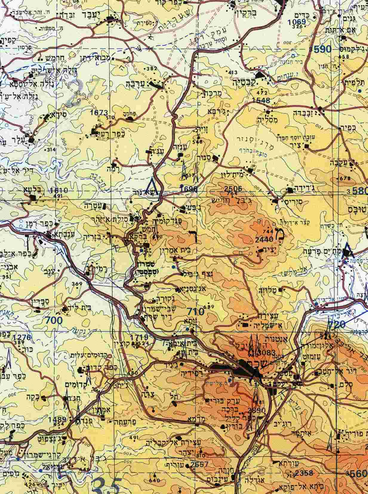
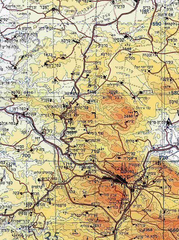
| nıkayên | 12:29, 8 Tışrino Verên 2009 | | 1,233 - 1,656 (191 KB) | Etan J. Tal | {{Information |Description={{en|1=Section of topographical map of Nablus area (West Bank)}} |Source=Aeronautical Information Publication - Domestic (AIP) of the Israel Civil Aviation Administration – presently Civil Aviation Authority (CAA) |Aut |
Gurenayışê dosya
The following pages link to this file:
Gurenayışê dosyaya gılovere
Ena dosya wikiyanê binan de gureniyena.
- ar.wikipedia.org sero guriyayış
- arz.wikipedia.org sero guriyayış
- ast.wikipedia.org sero guriyayış
- bn.wikipedia.org sero guriyayış
- ca.wikipedia.org sero guriyayış
- ceb.wikipedia.org sero guriyayış
- el.wikipedia.org sero guriyayış
- en.wikipedia.org sero guriyayış
- eo.wikipedia.org sero guriyayış
- es.wikipedia.org sero guriyayış
- eu.wikipedia.org sero guriyayış
- gl.wikipedia.org sero guriyayış
- he.wikipedia.org sero guriyayış
- hu.wikipedia.org sero guriyayış
- ko.wikipedia.org sero guriyayış
- ml.wikipedia.org sero guriyayış
- nl.wikipedia.org sero guriyayış
- nn.wikipedia.org sero guriyayış
- pt.wikipedia.org sero guriyayış
- ro.wikipedia.org sero guriyayış
- uk.wikipedia.org sero guriyayış
- vi.wikipedia.org sero guriyayış
- www.wikidata.org sero guriyayış