Dosya:Locator map Iran Alborz Province.png
Deha berz agozney cı çıniyo
Locator_map_Iran_Alborz_Province.png (672 × 600 pikselan, ebatê dosya: 143 KB, MIME tipê cı: image/png)
| Na dosya depoyê Wikimedia Commons de esta u terefê proceyanê binan ra gureniyena. Cêr dê şınasiya dosyay pela mocniyeno. |
| Şınasnayış |
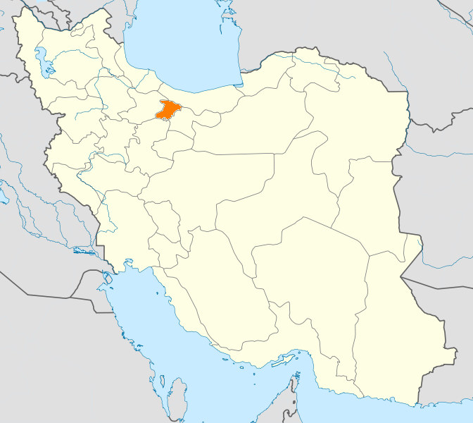
English: Location map of Iran. Equirectangular projection. Strechted by 118.0%. Geographic limits of the map: * N: 40.0° N * S: 24.5° N * W: 43.5° E * E: 64.0° E Made with Natural Earth. Free vector and raster map data @ naturalearthdata.com. |
| Tarix | (UTC) |
| Çıme | |
| Nuştekar |
|
| no fotraf rotuşin biyo, fotrafi sero hebe ki vırnayış biyo. vırnayışi zi: New map with Alborz province highlighted..orcinal fotrafo tiya de yo: Iran location map.svg. fotrafdı sazbiyayış zi WikiDaisy kerdo.
|
Ez, ke ena dosya viraste, bine ena lisansan ser cap kena:
Ena dosya binê Creative Commons Attribution-Share Alike 3.0 Unported lisans biya.
- Nê weçenegan dê xoseri:
- bare kerdene – qe gure kopya kerdişi, vila kerdişi u şawitişi
- qe reyna mix kerdişi – qe kabul kerdişi gure
- bine enê şarti:
- gıredayış – Lazımo ke şıma icazet bıdê, lisansi rê link, vuriyayış ke biyo belû kerê. Ney şıma usulên ra şenê bıkerê, labelê karkerdış u iştirakê şıma terefê wayirê lisansi ra zey qebulbiyene yew qeyde çıniyo.
- sey yewbini barekerdış – Meqaleyi ke reyna têv dê, tadê ya zi fına inşa bıkerê, iştırakê şıma lazımo ke zey orcinali same or compatible license bın de vıla kerê.

|
Şıma şenê ena dosya kopya kerê, vıla kerê ya zi bıvırnê bınê GNU Free Documentation License, Versiyon 1.2 ya zi versiyonane ke cap biye pê Free Software Foundation; pê nê Invariant Sections, nê Front-Cover Texts u nê Back-Cover Texts. You qısımê kopya bine GNU Free Documentation License estê. |
Ti eskena lisanse xo biwecini.
Qeydê barkerdışê oricinali
This image is a derivative work of the following images:
- File:Iran_location_map.svg licensed with Cc-by-sa-3.0, GFDL
- 2010-07-11T20:08:23Z Uwe Dedering 1200x1071 (655114 Bytes) 31. province Alborz
- 2010-02-18T17:44:29Z Uwe Dedering 1200x1071 (721726 Bytes) Bahrain above water, no disputed countries
- 2010-02-18T13:00:48Z Uwe Dedering 1200x1071 (725716 Bytes) {{Information |Description={{en|1=Location map of Iran. Equirectangular projection. Strechted by 118.0%. Geographic limits of the map: * N: 40.0° N * S: 24.5° N * W: 43.5° E * E: 64.0° E Made with Natural Earth. Fre
Uploaded with derivativeFX
Verêniya dosya
Seba diyayışê viyarteyê dosya ra tarixê ke qısımê tarix/zemani derê inan bıtıkne.
| Tarix/Zeman | Resımo qıckek | Ebadi | Karber | Mışewre | |
|---|---|---|---|---|---|
| nıkayên | 20:48, 24 Çele 2011 | | 672 - 600 (143 KB) | WikiDaisy | {{Information |Description={{en|1=Location map of Iran. Equirectangular projection. Strechted by 118.0%. Geographic limits of the map: * N: 40.0° N * S: 24.5° N * W: 43.5° E * E: 64.0° E Made with Natural Earth. Free vector and raster map data @ |
Gurenayışê dosya
There are no pages that link to this file.
Gurenayışê dosyaya gılovere
Ena dosya wikiyanê binan de gureniyena.
- ceb.wikipedia.org sero guriyayış
- hak.wikipedia.org sero guriyayış
- hi.wikipedia.org sero guriyayış
- hr.wikipedia.org sero guriyayış
- mk.wikipedia.org sero guriyayış
- mr.wikipedia.org sero guriyayış
- no.wikipedia.org sero guriyayış
- pa.wikipedia.org sero guriyayış
- pl.wikipedia.org sero guriyayış
- pl.wikivoyage.org sero guriyayış
- ps.wikipedia.org sero guriyayış
- sco.wikipedia.org sero guriyayış
- sh.wikipedia.org sero guriyayış
- sv.wikipedia.org sero guriyayış
- tr.wikipedia.org sero guriyayış
- Kerec
- İran'daki yerleşim birimleri listesi
- Elburz (eyalet)
- Kerec şehristanı
- Nezerabad şehristanı
- Savucbulag şehristanı
- Şablon:Elburz Eyaleti
- Nezerabad
- Heştgerd
- Kerec merkezî bahşı
- İştihard şehristanı
- Asara bahşı
- Nezerabad merkezî bahşı
- Tankaman bahşı
- Savucbulag merkezî bahşı
- Çendar bahşı
- Çeharbağ bahşı
- Taligan merkezî bahşı
- Asara
- İştihard
- Taligan
- Germdere
- Kemalşehr
- Mahdeşt
- Meşkindeşt
- Muhammedşehr
- Çeharbağ
- Gülsar
- Kuhsar
- Yeni Heştgerd
- ug.wikipedia.org sero guriyayış
- war.wikipedia.org sero guriyayış
- zh-min-nan.wikipedia.org sero guriyayış
- zh.wikipedia.org sero guriyayış