Dosya:Mamoudzou-Port.jpg

Vervênayışê ebadê: 800 × 600 piksel. Agoznayışê bini: 320 × 240 piksel | 640 × 480 piksel | 1,024 × 768 piksel | 1,280 × 960 piksel | 1,632 × 1,224 piksel.
Ebato oricinale (1,632 × 1,224 pikselan, ebatê dosya: 347 KB, MIME tipê cı: image/jpeg)
| Na dosya depoyê Wikimedia Commons de esta u terefê proceyanê binan ra gureniyena. Cêr dê şınasiya dosyay pela mocniyeno. |
Xulasa
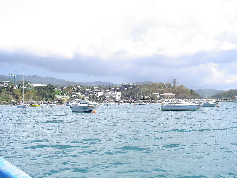
| Şınasnayış | Mamoudzou waterfront |
| Tarix | |
| Çıme | Mamoudzou waterfront |
| Nuştekar | mwanasimba from La Réunion |
| Camera location | | View this and other nearby images on: OpenStreetMap |
|---|
Lisans
Ena dosya binê Creative Commons Attribution-Share Alike 2.0 Generic lisans biya.
- Nê weçenegan dê xoseri:
- bare kerdene – qe gure kopya kerdişi, vila kerdişi u şawitişi
- qe reyna mix kerdişi – qe kabul kerdişi gure
- bine enê şarti:
- gıredayış – Lazımo ke şıma icazet bıdê, lisansi rê link, vuriyayış ke biyo belû kerê. Ney şıma usulên ra şenê bıkerê, labelê karkerdış u iştirakê şıma terefê wayirê lisansi ra zey qebulbiyene yew qeyde çıniyo.
- sey yewbini barekerdış – Meqaleyi ke reyna têv dê, tadê ya zi fına inşa bıkerê, iştırakê şıma lazımo ke zey orcinali same or compatible license bın de vıla kerê.
| This image was originally posted to Flickr by mwanasimba at https://www.flickr.com/photos/30273175@N06/2852607072. It was reviewed on 23 Gulane 2010 by FlickreviewR and was confirmed to be licensed under the terms of the cc-by-sa-2.0. |
Verêniya dosya
Seba diyayışê viyarteyê dosya ra tarixê ke qısımê tarix/zemani derê inan bıtıkne.
| Tarix/Zeman | Resımo qıckek | Ebadi | Karber | Mışewre | |
|---|---|---|---|---|---|
| nıkayên | 18:55, 22 Gulane 2010 | | 1,632 - 1,224 (347 KB) | Ji-Elle | {{Information |Description=Mamoudzou waterfront |Source=[http://www.flickr.com/photos/30273175@N06/2852607072/ Mamoudzou waterfront] |Date=2008-09-13 08:11 |Author=[http://www.flickr.com/people/30273175@N06 mwanasimba] from La Réunion |Permission= |other |
Gurenayışê dosya
The following pages link to this file:
Gurenayışê dosyaya gılovere
Ena dosya wikiyanê binan de gureniyena.
- azb.wikipedia.org sero guriyayış
- ca.wikipedia.org sero guriyayış
- cs.wikipedia.org sero guriyayış
- da.wikipedia.org sero guriyayış
- eu.wikipedia.org sero guriyayış
- he.wikipedia.org sero guriyayış
- hr.wikipedia.org sero guriyayış
- ka.wikipedia.org sero guriyayış
- lt.wikipedia.org sero guriyayış
- lv.wikipedia.org sero guriyayış
- nl.wikipedia.org sero guriyayış
- pt.wikipedia.org sero guriyayış
- sco.wikipedia.org sero guriyayış
- sh.wikipedia.org sero guriyayış
- sr.wikipedia.org sero guriyayış
- tl.wikipedia.org sero guriyayış
- uk.wikipedia.org sero guriyayış
- xmf.wikipedia.org sero guriyayış