Dosya:Osaka in Osaka Prefecture Ja.svg

Ebato oricinale (Dosyay SVGi, nominal 490 × 690 pikseli, ebadê dosya: 30 KB)
| Na dosya depoyê Wikimedia Commons de esta u terefê proceyanê binan ra gureniyena. Cêr dê şınasiya dosyay pela mocniyeno. |
Xulasa
| Şınasnayış |
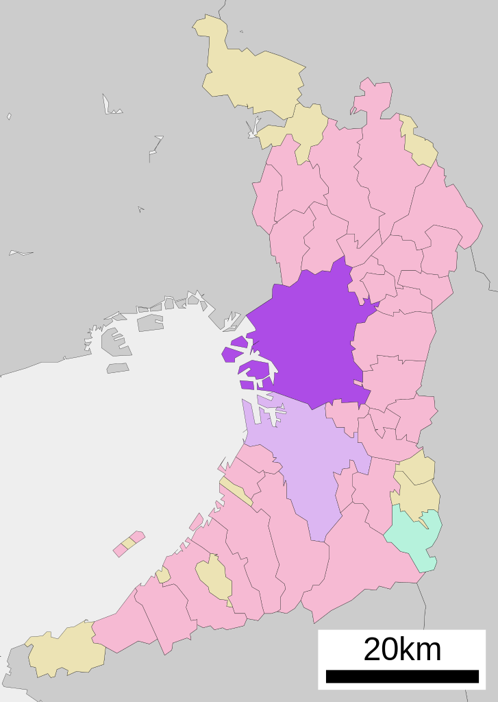
English: Location of Osaka in Osaka Prefecture
|
||
| Tarix | |||
| Çıme |
|
||
| Nuştekar | Lincun | ||
| Destur (Reyna sixulnayise ena dosya) |
|
Lisans

|
Şıma şenê ena dosya kopya kerê, vıla kerê ya zi bıvırnê bınê GNU Free Documentation License, Versiyon 1.2 ya zi versiyonane ke cap biye pê Free Software Foundation; pê nê Invariant Sections, nê Front-Cover Texts u nê Back-Cover Texts. You qısımê kopya bine GNU Free Documentation License estê. |
- Nê weçenegan dê xoseri:
- bare kerdene – qe gure kopya kerdişi, vila kerdişi u şawitişi
- qe reyna mix kerdişi – qe kabul kerdişi gure
- bine enê şarti:
- gıredayış – Lazımo ke şıma icazet bıdê, lisansi rê link, vuriyayış ke biyo belû kerê. Ney şıma usulên ra şenê bıkerê, labelê karkerdış u iştirakê şıma terefê wayirê lisansi ra zey qebulbiyene yew qeyde çıniyo.
- sey yewbini barekerdış – Meqaleyi ke reyna têv dê, tadê ya zi fına inşa bıkerê, iştırakê şıma lazımo ke zey orcinali same or compatible license bın de vıla kerê.
Qeydê barkerdışê oricinali
| This file was moved from Japanese Wikipedia.
See below for original file information. | ||||||||||||||||||||||||
| ||||||||||||||||||||||||
|
| ||||||||||||||||||||||||
Verêniya dosya
Seba diyayışê viyarteyê dosya ra tarixê ke qısımê tarix/zemani derê inan bıtıkne.
| Tarix/Zeman | Resımo qıckek | Ebadi | Karber | Mışewre | |
|---|---|---|---|---|---|
| nıkayên | 08:34, 22 Tışrino Verên 2020 | | 490 - 690 (30 KB) | AichiWikiFixer | Updated as File:Map_of_Osaka_Prefecture_Ja.svg |
| 20:16, 17 Nisane 2008 |  | 500 - 772 (16 KB) | Krisgrotius | {{Information| |Description= Location of Osaka in Osaka Prefecture |Source= Japanese wiki [http://ja.wikipedia.org/wiki/%E7%94%BB%E5%83%8F:%E5%9F%BA%E7%A4%8E%E8%87%AA%E6%B2%BB%E4%BD%93%E4%BD%8D%E7%BD%AE%E5%9B%B3_27100.svg] |Date=~~~~~ |Author=[[:ja: � | |
| 13:36, 5 Tışrino Verên 2007 |  | 500 - 772 (16 KB) | Lincun | {{基礎自治体位置図画像情報|大阪府|大阪市}} |
Gurenayışê dosya
There are no pages that link to this file.
Gurenayışê dosyaya gılovere
Ena dosya wikiyanê binan de gureniyena.
- ar.wikipedia.org sero guriyayış
- arz.wikipedia.org sero guriyayış
- azb.wikipedia.org sero guriyayış
- bcl.wikipedia.org sero guriyayış
- bn.wikipedia.org sero guriyayış
- ca.wikipedia.org sero guriyayış
- ceb.wikipedia.org sero guriyayış
- ckb.wikipedia.org sero guriyayış
- cr.wikipedia.org sero guriyayış
- de.wikipedia.org sero guriyayış
- en.wikipedia.org sero guriyayış
- es.wikipedia.org sero guriyayış
- fa.wikipedia.org sero guriyayış
- fi.wikipedia.org sero guriyayış
- frr.wikipedia.org sero guriyayış
- fr.wikipedia.org sero guriyayış
- fr.wiktionary.org sero guriyayış
- fy.wikipedia.org sero guriyayış
- ia.wikipedia.org sero guriyayış
- id.wikipedia.org sero guriyayış
- ilo.wikipedia.org sero guriyayış
- incubator.wikimedia.org sero guriyayış
- it.wikipedia.org sero guriyayış
- ja.wikipedia.org sero guriyayış
- ko.wikipedia.org sero guriyayış
- mi.wikipedia.org sero guriyayış
- mk.wikipedia.org sero guriyayış
- ml.wikipedia.org sero guriyayış
- ms.wikipedia.org sero guriyayış
- nl.wikipedia.org sero guriyayış
- no.wikipedia.org sero guriyayış
- pnb.wikipedia.org sero guriyayış
- sat.wikipedia.org sero guriyayış
- sco.wikipedia.org sero guriyayış
- sd.wikipedia.org sero guriyayış
- simple.wikipedia.org sero guriyayış
- si.wikipedia.org sero guriyayış
- sk.wikipedia.org sero guriyayış
- sr.wikipedia.org sero guriyayış
Yê na dosya gurenayışê gıloveri tayêna bıvêne.