Dosya:Saskatchewan-map.png
Deha berz agozney cı çıniyo
Saskatchewan-map.png (280 × 230 pikselan, ebatê dosya: 15 KB, MIME tipê cı: image/png)
| Na dosya depoyê Wikimedia Commons de esta u terefê proceyanê binan ra gureniyena. Cêr dê şınasiya dosyay pela mocniyeno. |
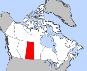
Map of Saskatchewan
Projection: Lambert azimuthal equal-area
Geospatial data from: The Atlas of Canada, The National Atlas of the United States and U.S. Geological Survey
Cartographer: John Fowler
| Ez, Wêrê ena teliferê, nê kari Malê şarideye ezo heserena. Dınya heme ca dı ravêreno. Tay dewletan dı no kanuniyey heta mıkum nêbone; o haldı: Ez, ena karer qande herhangi yew amaci, be şert, hendı ke legali icab nikeni, şari hemi re ezo mısade dana. |
Verêniya dosya
Seba diyayışê viyarteyê dosya ra tarixê ke qısımê tarix/zemani derê inan bıtıkne.
| Tarix/Zeman | Resımo qıckek | Ebadi | Karber | Mışewre | |
|---|---|---|---|---|---|
| nıkayên | 12:18, 24 Adare 2005 | | 280 - 230 (15 KB) | Voyager | Map of Saskatchewan Projection: Lambert azimuthal equal-area Geospatial data from: [http://atlas.gc.ca/ The Atlas of Canada], [http://www.nationalatlas.gov/ The National Atlas of the United States] and [http://www.usgs.gov U.S. Geological Survey] Carto |
Gurenayışê dosya
There are no pages that link to this file.
Gurenayışê dosyaya gılovere
Ena dosya wikiyanê binan de gureniyena.
- bat-smg.wikipedia.org sero guriyayış
- br.wikipedia.org sero guriyayış
- en.wikipedia.org sero guriyayış
- en.wiktionary.org sero guriyayış
- eo.wikipedia.org sero guriyayış
- frr.wikipedia.org sero guriyayış
- gd.wikipedia.org sero guriyayış
- hu.wikipedia.org sero guriyayış
- hu.wiktionary.org sero guriyayış
- io.wikipedia.org sero guriyayış
- kw.wikipedia.org sero guriyayış
- lij.wikipedia.org sero guriyayış
- nn.wikipedia.org sero guriyayış
- pam.wikipedia.org sero guriyayış
- pms.wikipedia.org sero guriyayış
- sc.wikipedia.org sero guriyayış
- sh.wikipedia.org sero guriyayış
- ta.wikipedia.org sero guriyayış
- uk.wikipedia.org sero guriyayış
- vo.wikipedia.org sero guriyayış
- wa.wikipedia.org sero guriyayış
- xmf.wikipedia.org sero guriyayış
- zh-min-nan.wikipedia.org sero guriyayış