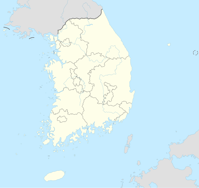
Dosya:South Korea adm location map.svg

Ebadê verqaytê PNG na dosyay SVG: 635 × 599 piksel. Agoznayışê bini: 254 × 240 piksel | 509 × 480 piksel | 814 × 768 piksel | 1,085 × 1,024 piksel | 2,171 × 2,048 piksel | 1,772 × 1,672 piksel.
Ebato oricinale (Dosyay SVGi, nominal 1,772 × 1,672 pikseli, ebadê dosya: 375 KB)
Verêniya dosya
Seba diyayışê viyarteyê dosya ra tarixê ke qısımê tarix/zemani derê inan bıtıkne.
| Tarix/Zeman | Resımo qıckek | Ebadi | Karber | Mışewre | |
|---|---|---|---|---|---|
| nıkayên | 15:25, 5 Temuze 2023 |  | 1,772 - 1,672 (375 KB) | NordNordWest | upd coastline |
| 04:49, 4 Temuze 2023 |  | 1,772 - 1,672 (388 KB) | Nv7801 | Daegu | |
| 19:48, 22 Hezirane 2016 |  | 1,772 - 1,672 (382 KB) | NordNordWest | corr | |
| 17:51, 13 Keşkelun 2015 |  | 1,772 - 1,672 (382 KB) | NordNordWest | == {{int:filedesc}} == {{Information |Description= {{de|1=Positionskarte von Südkorea}} {{en|1=Location map of South Korea}} {{Location map series N |stretching=120 |top=38.9 |bottom=33.0 |left=124.5 |right=132.0}} |Source={{Own using}} * United State... |
Gurenayışê dosya
The following pages link to this file:
Gurenayışê dosyaya gılovere
Ena dosya wikiyanê binan de gureniyena.
- ab.wikipedia.org sero guriyayış
- af.wikipedia.org sero guriyayış
- als.wikipedia.org sero guriyayış
- an.wikipedia.org sero guriyayış
- ar.wikipedia.org sero guriyayış
- كوريا الجنوبية
- كأس العالم 2002
- قالب:خريطة مواقع كوريا الجنوبية
- قالب:خارطة مواقع كوريا الجنوبية
- برنامج كوريا الجنوبية النووي
- كأس العالم تحت 20 سنة لكرة القدم 2017
- بوابة:كوريا الجنوبية
- قالب:Location map National parks of South Korea
- قالب:خارطة مسماة لتقسيمات كوريا الجنوبية الرئيسية
- التقسيم الإداري في كوريا الجنوبية
- قالب:خريطة محطات كوريا الجنوبية النووية
- بطولة آسيا للشباب لكرة القدم 1996
- كأس العالم تحت 17 سنة لكرة القدم 2007
- قائمة ملاعب كأس العالم
- بطولة آسيا لكرة اليد للرجال 2018
- arz.wikipedia.org sero guriyayış
- ast.wikipedia.org sero guriyayış
- Seúl
- Ganghwa
- Incheon
- Bucheon
- Goyang
- Seongnam
- Suwon
- Busan
- Ulsan
- Changwon
- Pohang
- Gimhae
- Biblioteca nacional de Corea
- Daegu
- Gwangju
- Estadiu Olímpicu de Pyeongchang
- Lotte World Tower
- Guro-gu
- Módulu:Mapa de llocalización/datos/Corea del Sur
- Módulu:Mapa de llocalización/datos/Corea del Sur/usu
- Copa Mundial de Fútbol de 2002
- Universidá Nacional de Seúl
- Gyeryong
- Aeropuertu Internacional d'Incheon
- Aeropuertu Internacional de Gimpo
Yê na dosya gurenayışê gıloveri tayêna bıvêne.


