Dosya:Trinitarian Church of Bratislava (10267484535).jpg
Vervênayışê ebadê: 800 × 531 piksel. Agoznayışê bini: 320 × 213 piksel | 640 × 425 piksel | 1,024 × 680 piksel | 1,280 × 850 piksel | 2,560 × 1,700 piksel | 4,288 × 2,848 piksel.
Ebato oricinale (4,288 × 2,848 pikselan, ebatê dosya: 3.24 MB, MIME tipê cı: image/jpeg)
| Na dosya depoyê Wikimedia Commons de esta u terefê proceyanê binan ra gureniyena. Cêr dê şınasiya dosyay pela mocniyeno. |
.jpg)
Xulasa
| Şınasnayış |
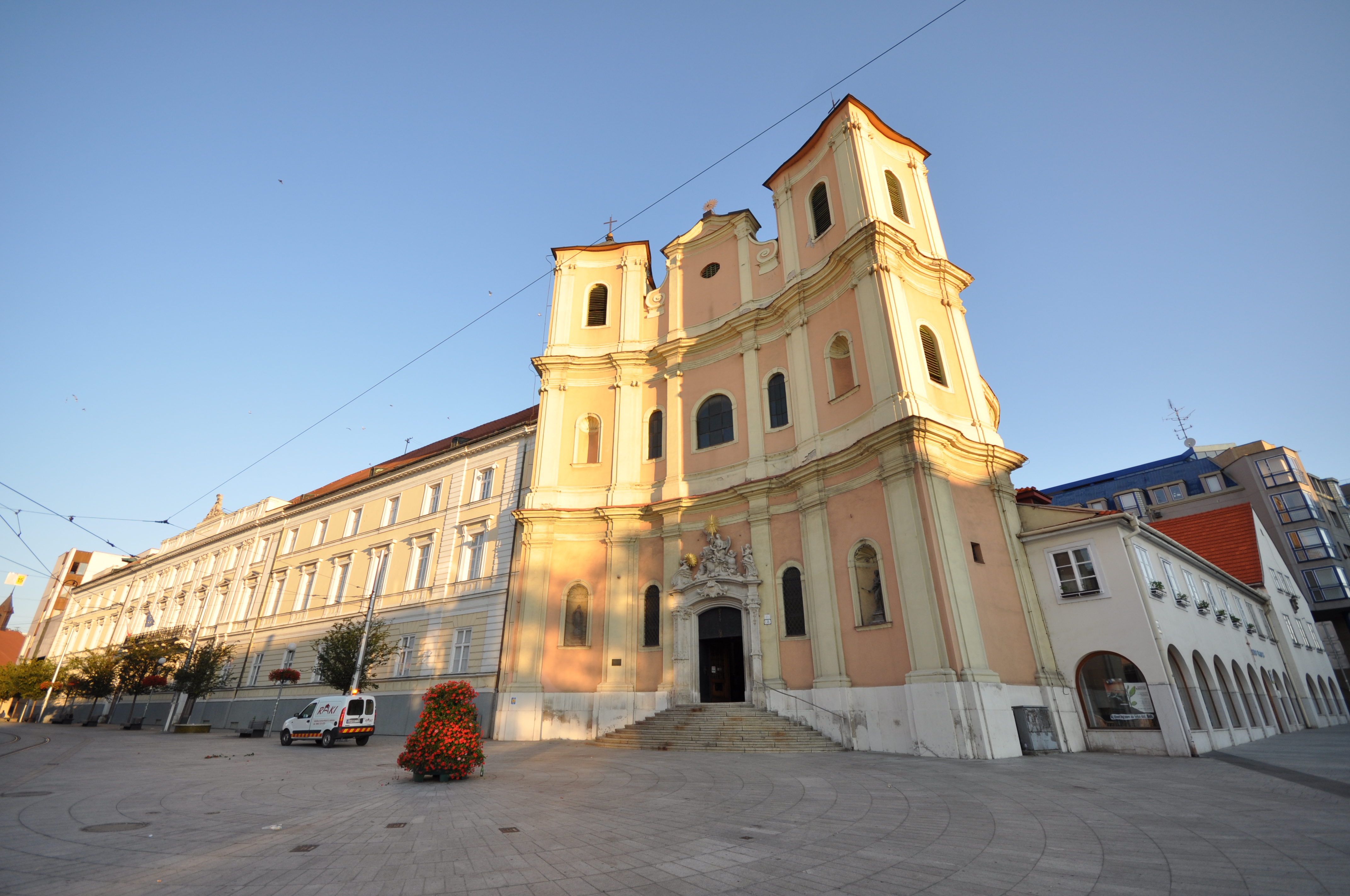
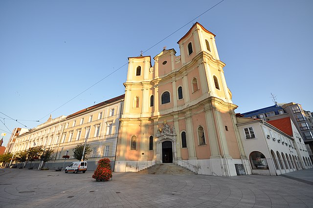
The Trinitarian Church or Trinity Church, full name Church of Saint John of Matha and Saint Felix of Valois (Slovak: Kostol trinitárov, Trinitársky kostol or Trojičný kostol or Kostol svätého Jána z Mathy a svätého Felixa z Valois; incorrectly Holy Trinity Church (Kostol Najsvätejšej Trojice)), is a Baroque-style church in Bratislava's Old Town borough, on the Župné námestie square. The church was built on the site of the older Church of St. Michael, which was demolished in 1529, along with the settlement of St. Michael, during the Ottoman wars, along with other suburbs, so as to see better the attacking Turks. The Trinitarian Order started construction of the church in 1717 and it was sanctified in 1727, although work in the interior continued into the first half of the 18th century [Wikipedia.org] |
| Tarix | |
| Çıme | Trinitarian Church of Bratislava |
| Nuştekar | Jorge Láscar from Australia |
| Camera location | | View this and other nearby images on: OpenStreetMap |
|---|
.jpg¶ms=048.146111_N_0017.106667_E_globe:Earth_type:camera_source:Flickr_&language=diq)
Lisans
Ena dosya bınê lisansê Şarê Afernayoği Gırêdayış 2.0 Bınge de lisans biya.
- Nê weçenegan dê xoseri:
- bare kerdene – qe gure kopya kerdişi, vila kerdişi u şawitişi
- qe reyna mix kerdişi – qe kabul kerdişi gure
- bine enê şarti:
- gıredayış – Lazımo ke şıma icazet bıdê, lisansi rê link, vuriyayış ke biyo belû kerê. Ney şıma usulên ra şenê bıkerê, labelê karkerdış u iştirakê şıma terefê wayirê lisansi ra zey qebulbiyene yew qeyde çıniyo.
| This image was originally posted to Flickr by Jorge Lascar at https://www.flickr.com/photos/8721758@N06/10267484535. It was reviewed on 2 Nisane 2014 by FlickreviewR and was confirmed to be licensed under the terms of the cc-by-2.0. |
Verêniya dosya
Seba diyayışê viyarteyê dosya ra tarixê ke qısımê tarix/zemani derê inan bıtıkne.
| Tarix/Zeman | Resımo qıckek | Ebadi | Karber | Mışewre | |
|---|---|---|---|---|---|
| nıkayên | 06:34, 2 Nisane 2014 | | 4,288 - 2,848 (3.24 MB) | Russavia | Transferred from Flickr |
Gurenayışê dosya
The following pages link to this file:
Gurenayışê dosyaya gılovere
Ena dosya wikiyanê binan de gureniyena.
- el.wikipedia.org sero guriyayış
- en.wikipedia.org sero guriyayış
- fy.wikipedia.org sero guriyayış
- hi.wikipedia.org sero guriyayış
- id.wikipedia.org sero guriyayış
- it.wikipedia.org sero guriyayış
- mt.wikipedia.org sero guriyayış
- simple.wikipedia.org sero guriyayış
- ur.wikipedia.org sero guriyayış
- vi.wikipedia.org sero guriyayış
.jpg)