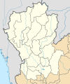
Dosya:Thailand Northern (17 provinces) location map.svg

Ebadê verqaytê PNG na dosyay SVG: 500 × 600 piksel. Agoznayışê bini: 200 × 240 piksel | 400 × 480 piksel | 640 × 768 piksel | 853 × 1,024 piksel | 1,707 × 2,048 piksel | 600 × 720 piksel.
Ebato oricinale (Dosyay SVGi, nominal 600 × 720 pikseli, ebadê dosya: 178 KB)
Verêniya dosya
Seba diyayışê viyarteyê dosya ra tarixê ke qısımê tarix/zemani derê inan bıtıkne.
| Tarix/Zeman | Resımo qıckek | Ebadi | Karber | Mışewre | |
|---|---|---|---|---|---|
| nıkayên | 21:26, 13 Keşkelun 2019 |  | 600 - 720 (178 KB) | ZeroSixTwo | User created page with UploadWizard |
Gurenayışê dosya
There are no pages that link to this file.
Gurenayışê dosyaya gılovere
Ena dosya wikiyanê binan de gureniyena.
- id.wikipedia.org sero guriyayış
- th.wikipedia.org sero guriyayış
- ไทยลีก 4 ฤดูกาล 2561 – โซนภาคเหนือ
- ไทยแลนด์ อเมเจอร์ลีก ฤดูกาล 2561 – โซนภาคเหนือ
- ไทยลีก 4 ฤดูกาล 2562 – โซนภาคเหนือ
- ไทยแลนด์ อเมเจอร์ลีก ฤดูกาล 2562 – โซนภาคเหนือ
- มอดูล:Location map/data/Thailand Northern (17 provinces)
- ไทยลีก 4 ฤดูกาล 2563 – โซนภาคเหนือ
- ไทยลีก 3 ฤดูกาล 2564–65 – โซนภาคเหนือ
- ไทยแลนด์ อเมเจอร์ลีก ฤดูกาล 2565 – โซนภาคเหนือ
- ไทยลีก 3 ฤดูกาล 2565–66 – โซนภาคเหนือ
- ไทยแลนด์ เซมิโปรลีก ฤดูกาล 2566 – โซนภาคเหนือ
- ไทยแลนด์ อเมเจอร์ลีก ฤดูกาล 2566 – โซนภาคเหนือ
- ไทยลีก 3 ฤดูกาล 2566–67 – โซนภาคเหนือ
- ไทยแลนด์ เซมิโปรลีก ฤดูกาล 2567 – โซนภาคเหนือ
- มอดูล:Location map/data/Thailand Northern (17 provinces)/doc
- ไทยลีก 3 ฤดูกาล 2567–68 – โซนภาคเหนือ